Temperatures have taken a tumble as we return to winter-like weather for part of this weekend.
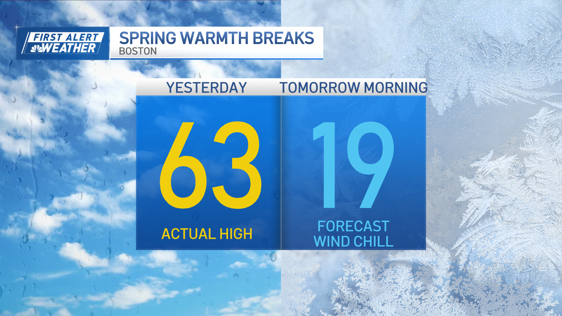
By this evening our temps will be in the 30s with wind chills in the 20s. Overnight it gets blustery with morning lows in the teens and 20s.
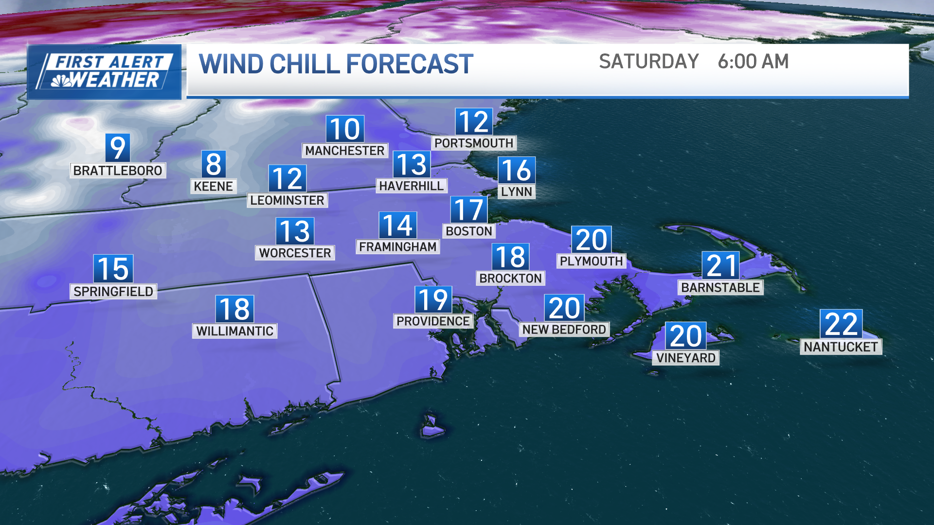
Wind chills drop into the single digits in the north country, to the teens across Boston and to the coast. Quite a contrast compared to Thursday’s high of 63!
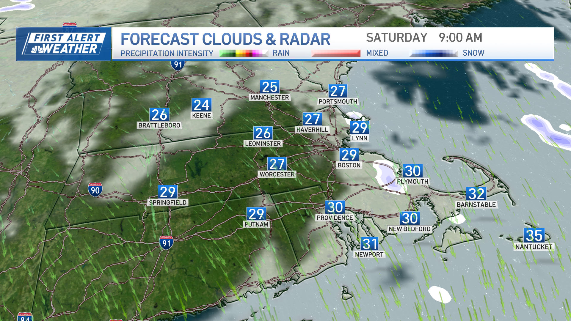
The persistent breeze may allow for ocean-effect flurries to snow showers along the North Shore, South Shore, to Cape Cod for Saturday morning. Watch for slick spots and spotty coatings of accumulation. By mid-morning, no accumulation is expected, but some flurries continue to fly around. The wind changes direction by midday as temps stay in the 30s.
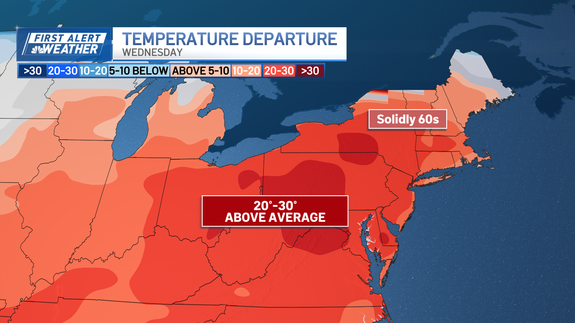
Sunday will be back to seasonable highs with temp reaching the 40s to 50 degrees under lots of sunshine and a gusty southwest wind. A more significant warm-up is on the way for next week as a ridge of high pressure builds in from the western and central U.S. through midweek. Highs may reach the 60s to near 70 degrees by Wednesday.
Source: News – Boston – necn