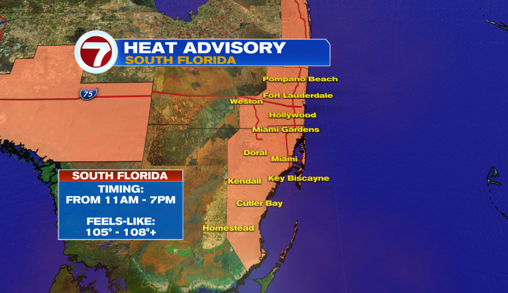
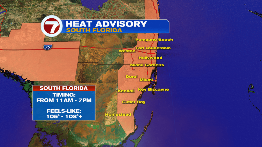
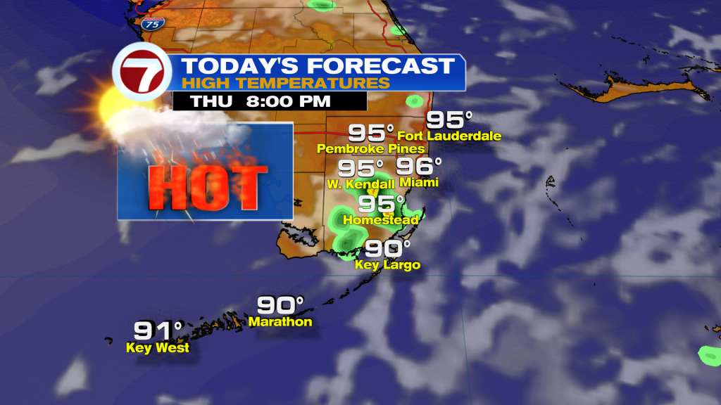
South Florida will continue to deal with dangerous heat today as temperatures climb into the mid to upper 90’s and heat index values reach 105 to 108 degrees this afternoon.
A Heat Advisory is in effect from 11 am until 7 pm for the East coast metro areas and portions of interior Collier County. The combination of heat and humidity can quickly lead to heat-related illnesses, especially for those spending extended periods outdoors. Stay hydrated, wear lightweight clothing, and take frequent breaks in air-conditioned spaces whenever possible.
While Saharan dust remains in place across the region, enough moisture is available for a few showers and storms to develop later today. Storm chances remain relatively low, but isolated to scattered activity is possible this afternoon and evening, particularly across interior South Florida and portions of the East coast metro.
Any storm that develops will be capable of producing: Frequent lightning, heavy downpours, gusty winds, and small hail
Because steering winds remain weak, storms will move slowly and could produce localized flooding where heavier rain persists.
Looking Ahead
The weather pattern begins to change on Friday as deeper tropical moisture starts moving back into South Florida. Rain and storm chances will increase, and a much wetter pattern is expected this weekend.
By Saturday and Sunday, widespread afternoon storms are likely with rain chances climbing into the 50 to 60 percent range. Some storms could become strong, bringing damaging wind gusts, frequent lightning, hail, and localized flooding.
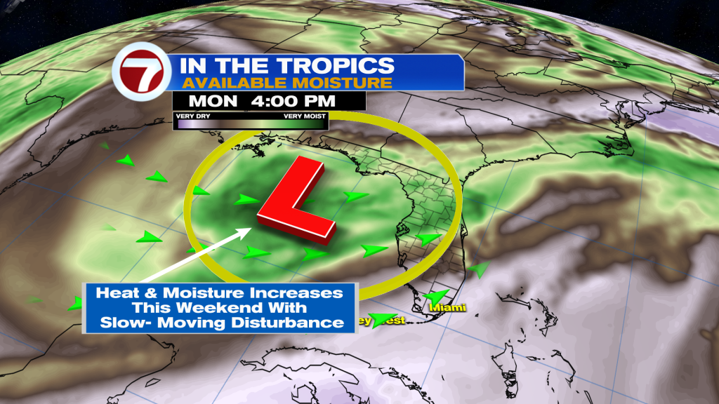
Tropics Update
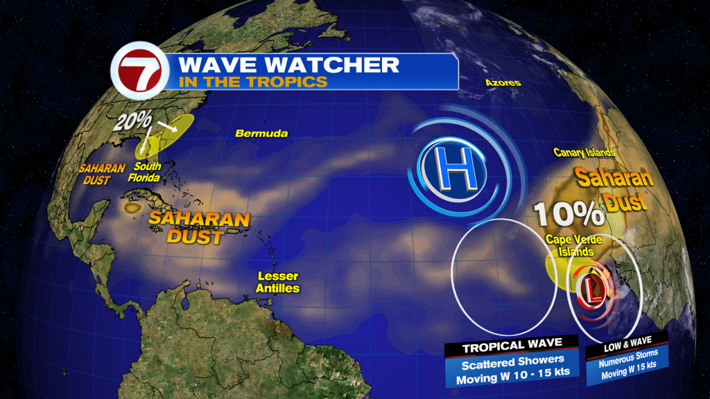
The National Hurricane Center is monitoring two areas:
- A tropical wave in the eastern Atlantic has a 10% chance of development over the next seven days.
-
- A potential area of low pressure may develop over the Northeastern Gulf this weekend, with a 20% chance of development through seven days.
-
Have a wonderful day South Florida and make it a safe one!
Vivian Gonzalez
Meteorologist, AMS Certified
WSVN Channel 7
Source: News Miami – Fox News