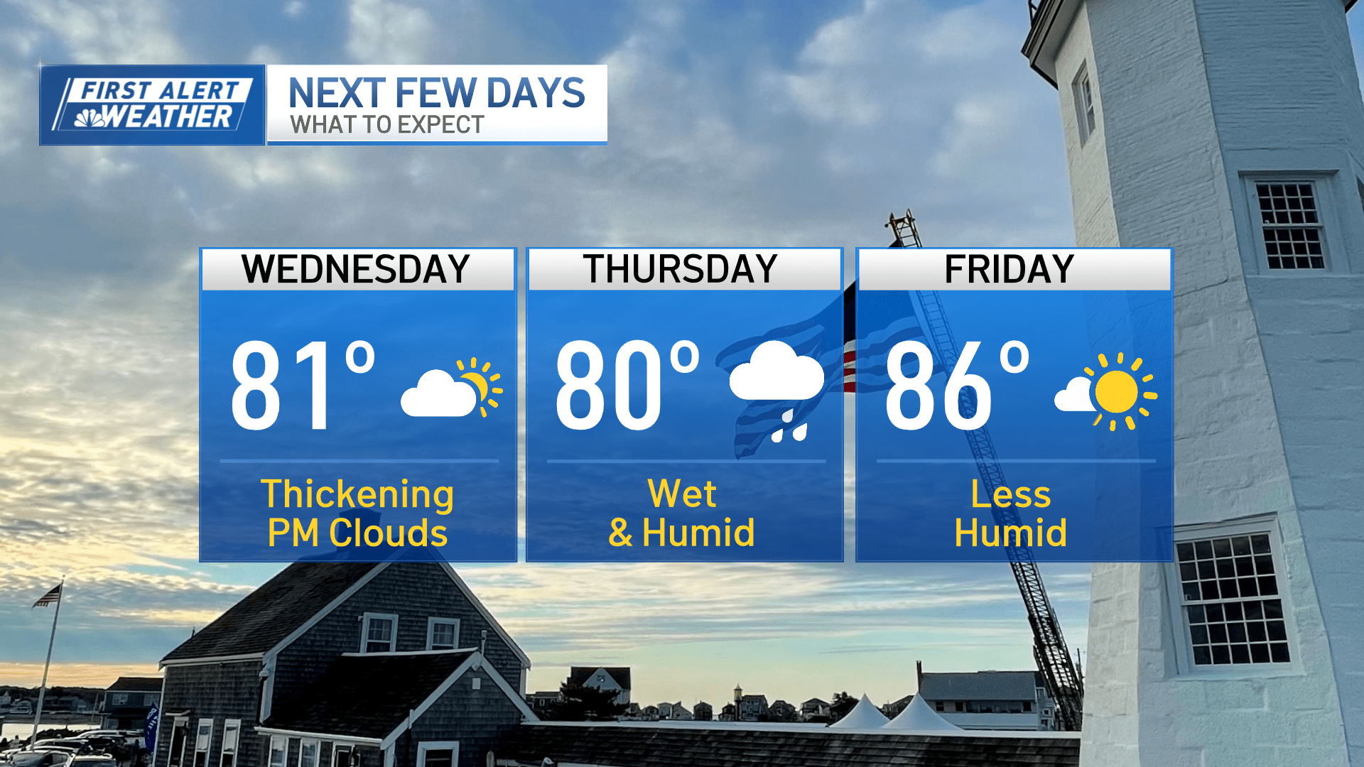
Top ten days may be behind us (for now), but today still stands tall.
Highs will sneak up near 80 as clouds thicken in the afternoon.
Some sprinkles may pop up along outer Route 2 toward Fitchburg, Gardner, and drift up to southern New Hampshire, but the rest of the area looks dry.
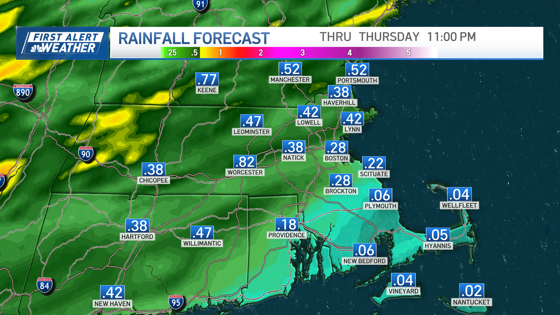
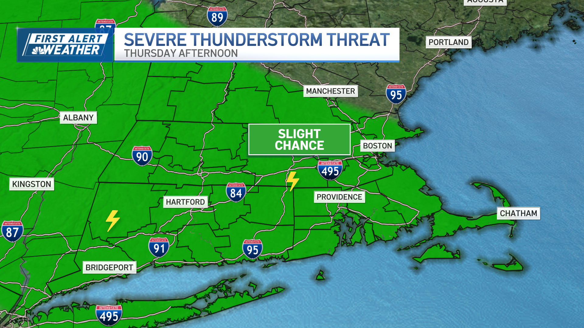
Far from it tomorrow as rain catches up to us early on. While it appears we may miss out on the heavy amounts, there’s still a quarter to third of an inch at play. And that doesn’t include the potential for thunderstorms in the afternoon.
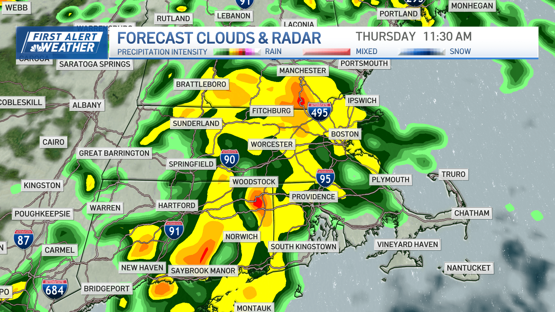
While there are still a few questions as to where they flare up, the threat has not diminished.
Severity is a function of how much sun we see (more sun=more intense), and right now there doesn’t appear to be enough time between when the morning rain moves out and the storms fire up. Still, any cells will feed off the warm, humid airmass and contain heavy rain/gusty winds into the afternoon and evening.
Humidity gets booted Friday as we return to midsummer form with highs in the mid-80s.
The weekend cools down as the humidity drops back.
We may see a sprinkle in the afternoons, but there are no worries for a washout.
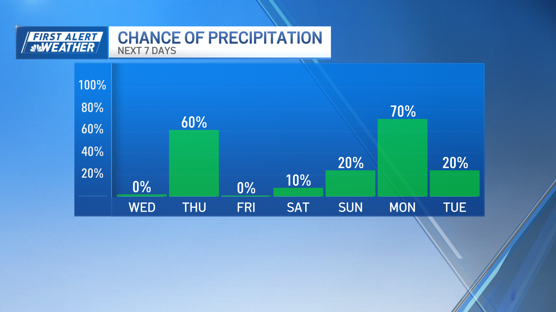
Longer range, widespread, steady rain may finally make it by Monday as a slow-moving system takes shape and moves over New England. Fingers crossed!
Source: News – Boston – necn