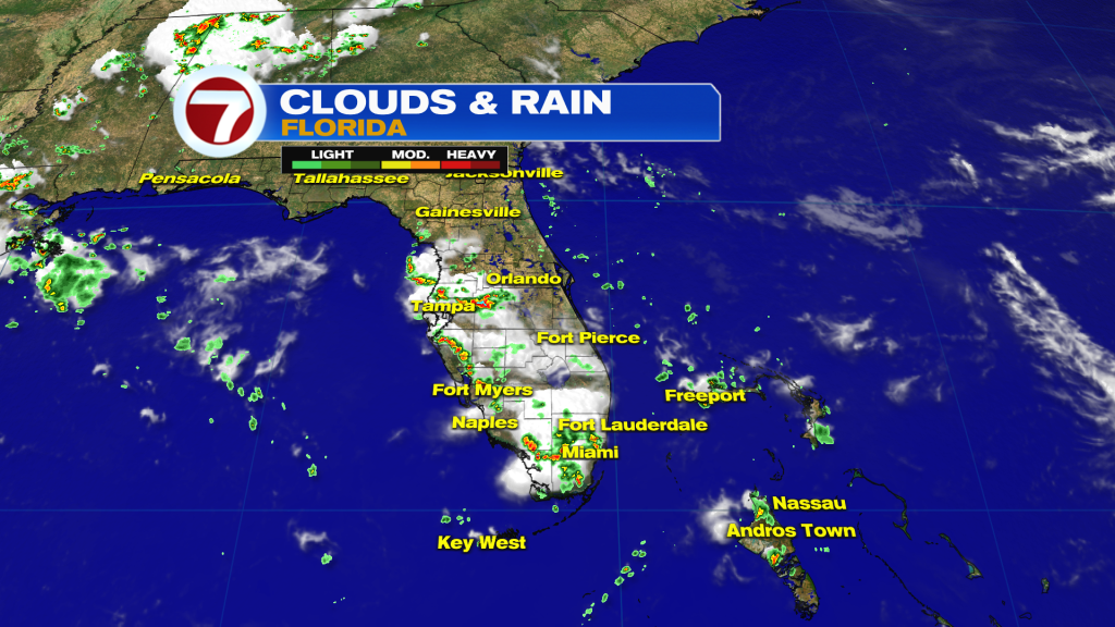
After a real absence of rain, a push of storms made for an active afternoon on Wednesday. Some of the thunderstorms had gusty winds yet the main concern was related to frequent lightning. Our lightning counter showed over 600 strikes during the peak, late in the afternoon.
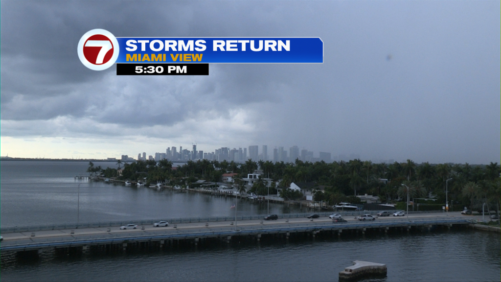
Scattered to numerous storms were spreading across most of south and central Florida. The initial flow was towards the west, or southwest, with general storm movement. Then, “break away” activity jogged east, crossing I-95 and eventually reaching the beach.
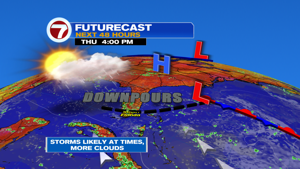
Another day of downpours is expected Thursday. They’ll mostly take shape as the air heats up so the mid-day and afternoon hours will be primed for wet weather. Since the wind flow remains light and variable (once again), storms could drift in multiple directions as the day continues. The weather map below shows what’s responsible for the unsettled conditions: A distant Low Pressure area and old boundary which extends west. This is an old remnant Front stretching back into Florida as a storm trigger.
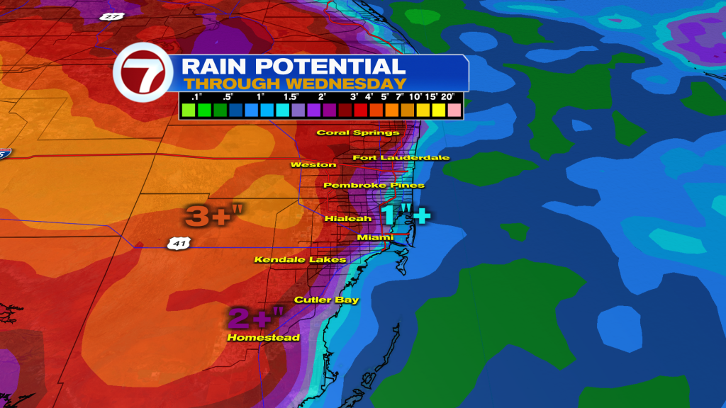
With heavy downpours and daily storms, the rain accumulation could be impressive over time. Our latest forecast models suggest some significant rainfall piling up across the western metro extending into the Everglades. Favored areas could pick up more than a couple inches of rain while the Atlantic beaches receive tallies closer to an inch.
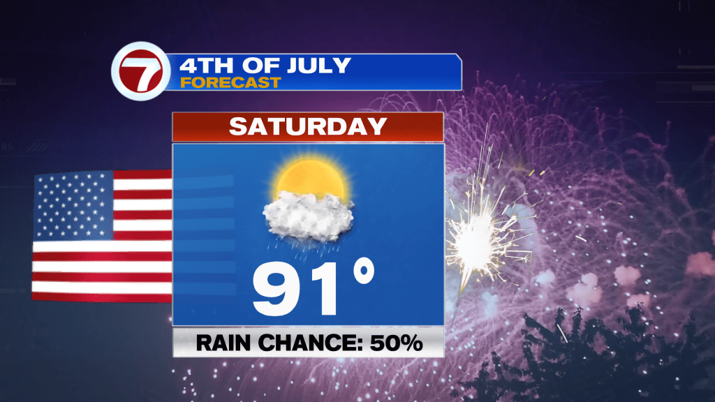
Perhaps the biggest focus is on the upcoming Holiday weekend, especially for the 4th of July. Here’s a check on the Saturday outlook (shown below).
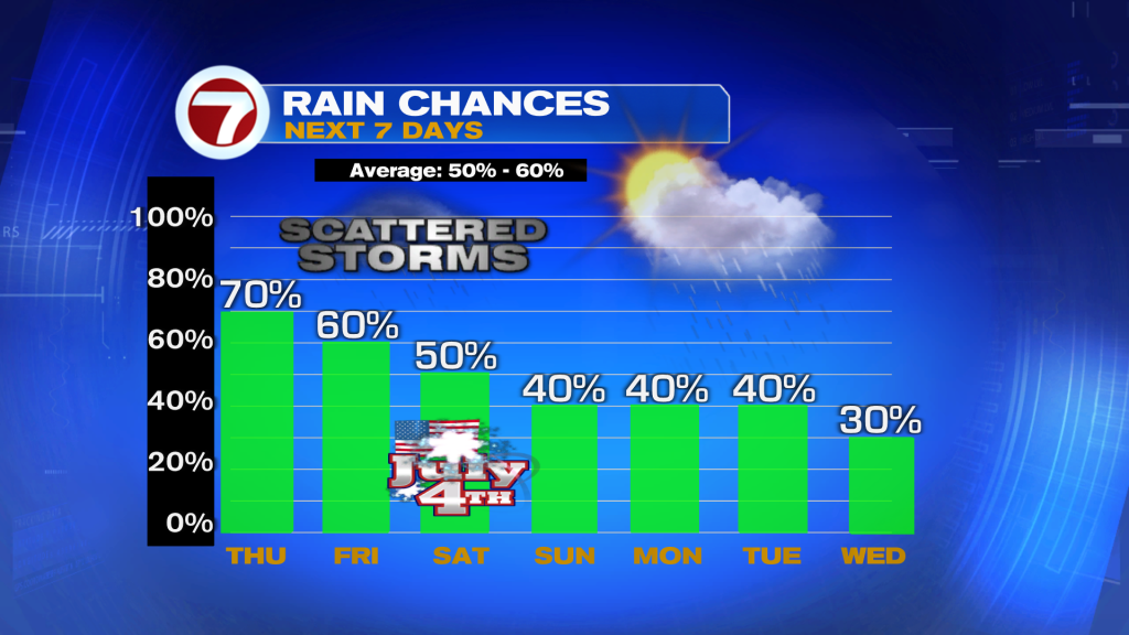
Upcoming weather is just about as “typical” as it gets for early July. A check on rain chances shows daily downpours are quite possible (although overall chances gradually come down next week).
Source: News Miami – Fox News