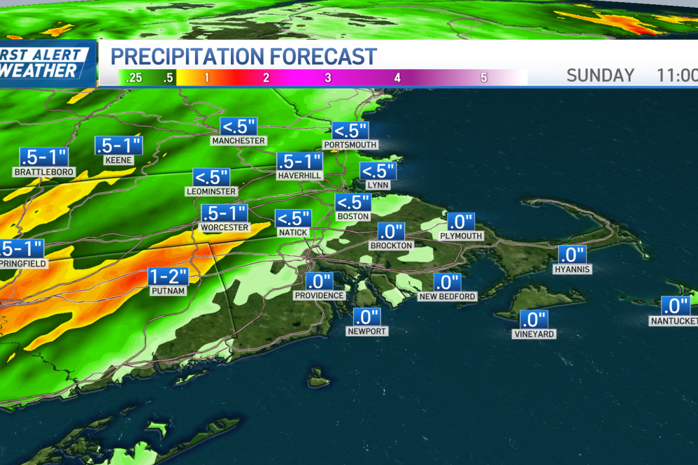
This cloudy weekend continues Sunday, with rain on the way at least for some of the Greater Boston area. Track the weather with our interactive radar below.
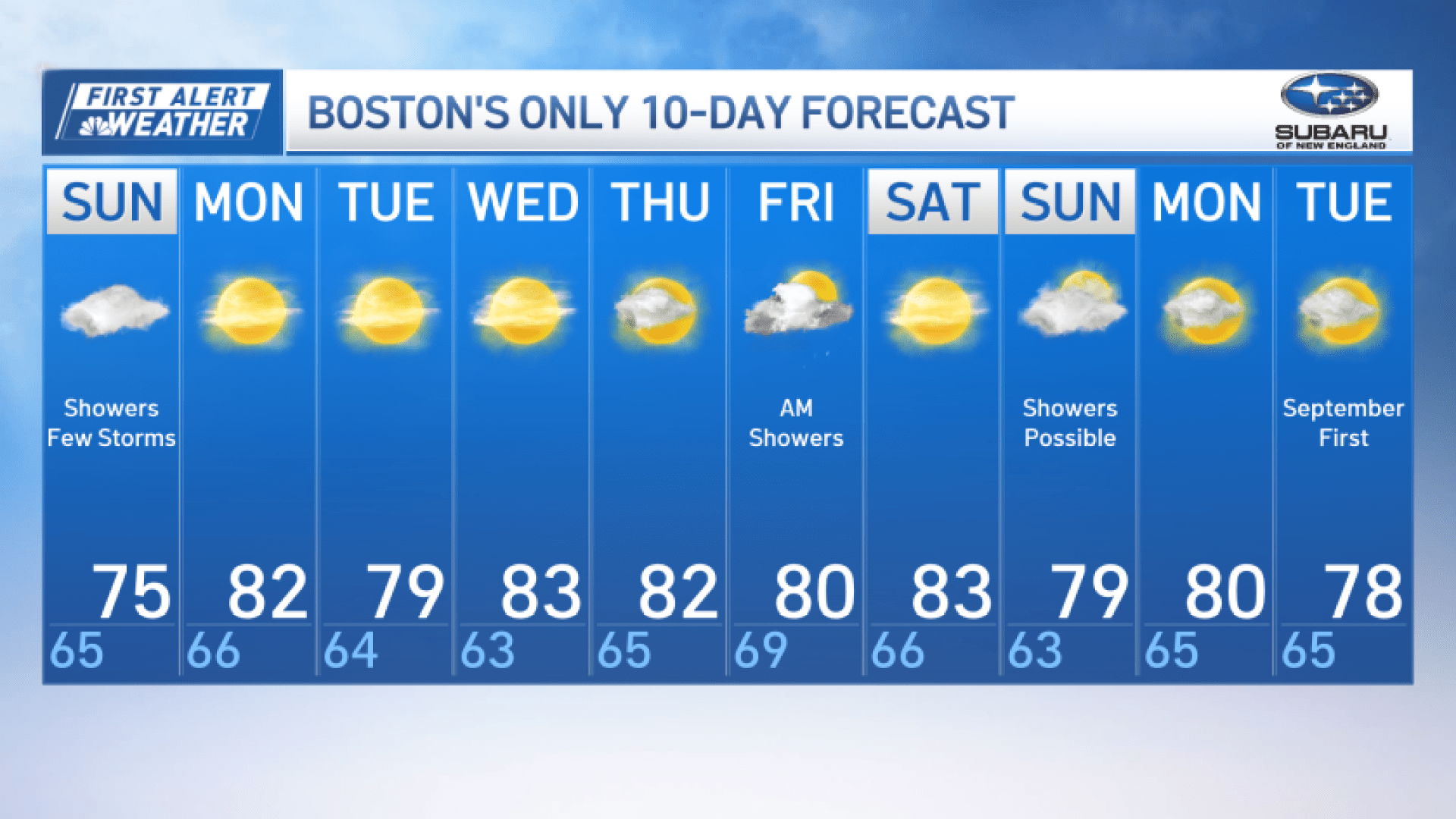
Sunday starts off muggy, with a few showers possible early, particularly toward the Cape and Islands.
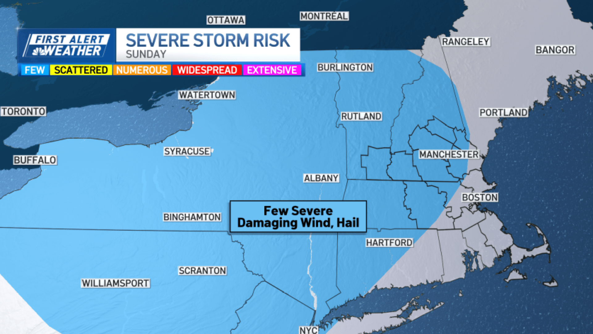
Much of the day will be dry, but another round of scattered showers and thunderstorms develop in the afternoon and early evening. The best rain chances are over central Massachusetts, the Merrimack Valley and southern New Hampshire, where an isolated strong to severe storm can’t be ruled out.
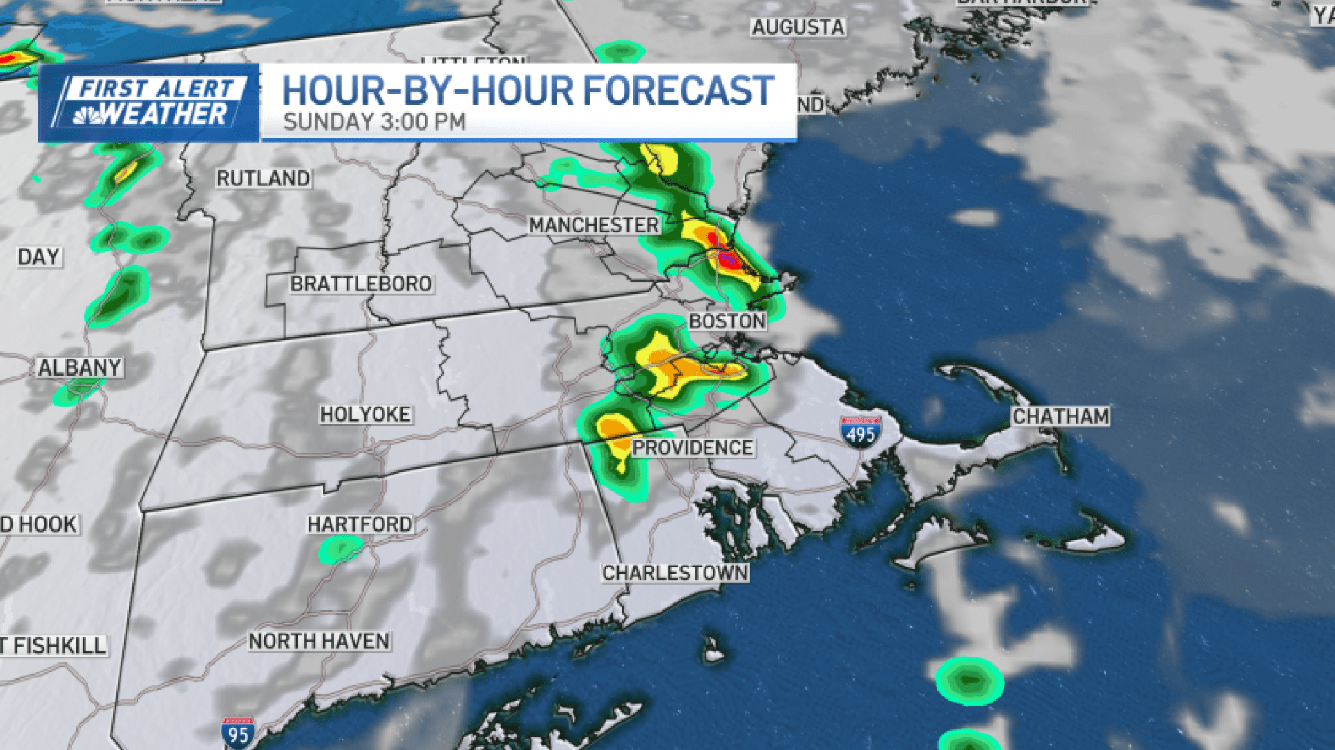
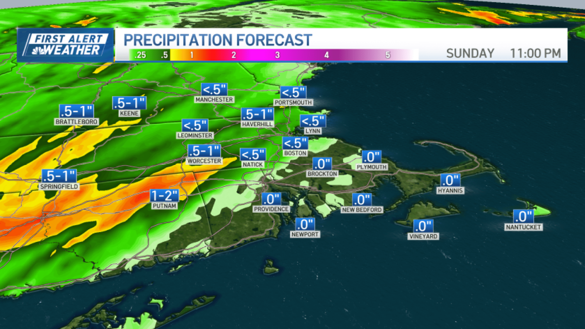
Storm coverage will not be impressive, but in one to two storms that do pop up, damaging wind gusts and brief torrential rain would be the main concerns.
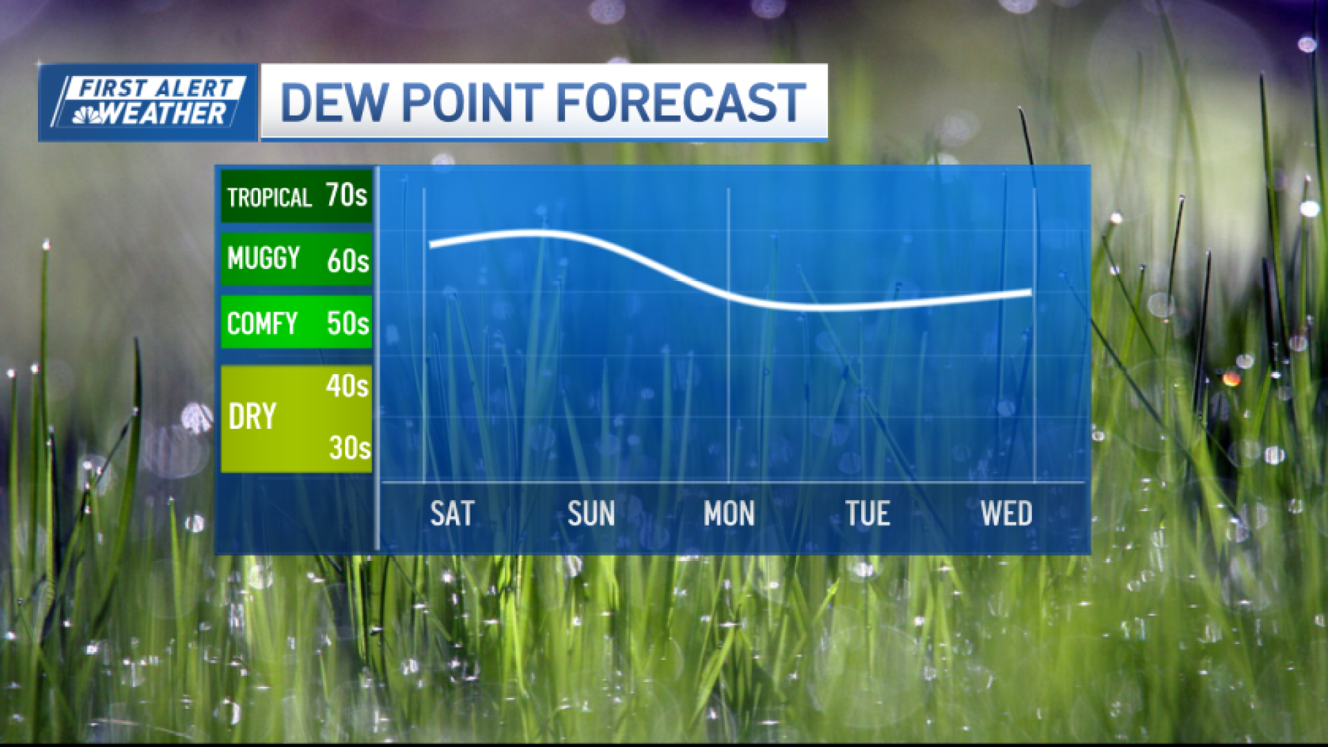
Otherwise, expect highs in the 70s with higher humidity than Saturday.
A cold front brings a change for Monday, with skies gradually clearing and humidity beginning to drop as temperatures remain seasonable.
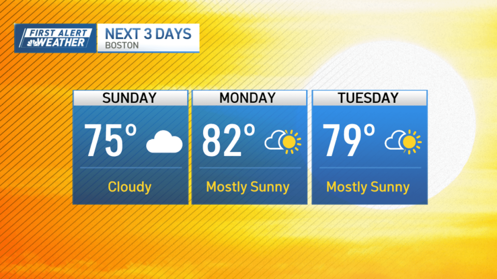
High pressure then keeps Tuesday and Wednesday mainly dry, with comfortable humidity and warmer temperatures.
Our next chance for rain arrives toward the end of the week, as another system approaches from the Great Lakes. Shower chances increase heading into the end of the week.
Source: News – Boston – necn