

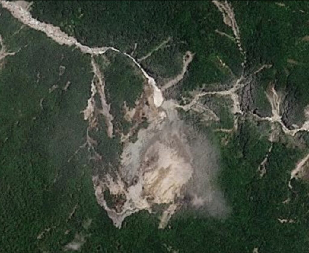
Planet Labs satellite imagery highlights how the Wanlixi landslide in Taiwan evolved prior to the main failure on 21 June, and how it has continued to move subsequently.

On 31 July 2026 I highlighted the valley-blocking Wanlixi landslide in Hualien County, Taiwan. The location of the landslide is 23.78859° N, 121.27236° E (for machine readable text that is: [23.78859, 121.27236] ).
The latest news from the Forestry and Nature Conservation Agency daily update is that “the lake is experiencing stable overflow with clear water; the dam structure has only experienced minor erosion and remains intact; the impact of the overflow on the downstream area is limited to the river channel.”
As I noted in my earlier post, this landslide was first noted around 21 June 2026. However, its dynamics are really interesting, as shown in the Planet Labs imagery.
So first, this is the landslide on 21 June 2026, the day of the failure:-
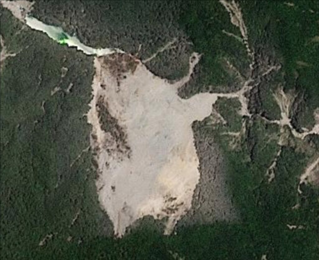
The valley was blocked and the lake was starting to form. Note the dust on the trees to the east of the landslide and, to a degree, to the north as well.
But let’s step back a day to 20 June 2026, the day prior to failure:-
On 20 June 2026, the slope was intact but showing very clear signs of distress, especially on the eastern side. Note that it had generated a large amount of dust, which is both on the trees and in the air. The river was still starting to become blocked. Note also the dust along the channel to the east of the landslide.
Let’s step back a little more than two months to 14 April 2026:-
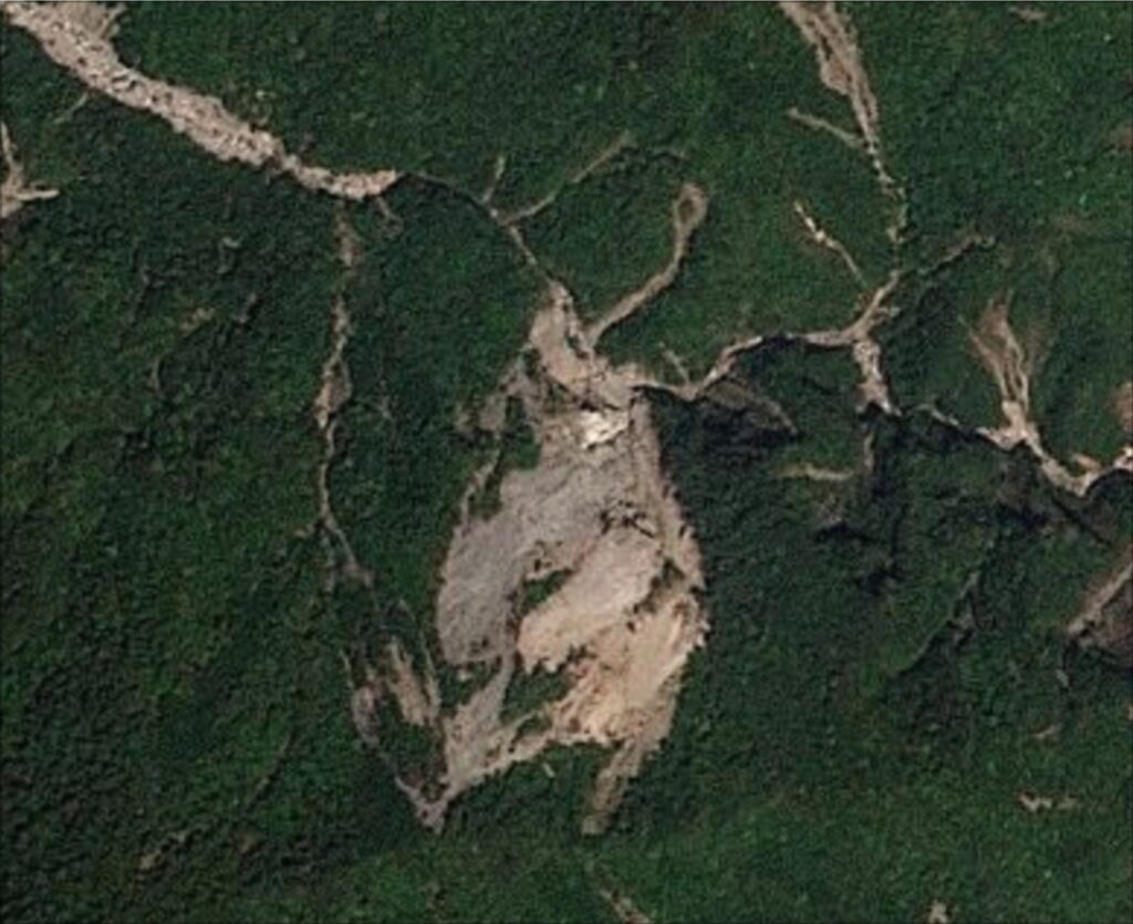
It is worth looking at an image compare to highlight how the landslide evolved over those nine weeks:-


On 9 April 2026 there was little dust, soi the landslide was deforming less quickly. The eastern side changed comparatively little over that nine week period to 20 June 2026, but the western side evolved enormously, with the mass fragmenting and moving downslope.
Let’s now jump to the post-failure dynamics. The most recent image to which I have access is 9 July 2026 (I now have a one month delay on my access to Planet Labs imagery):-
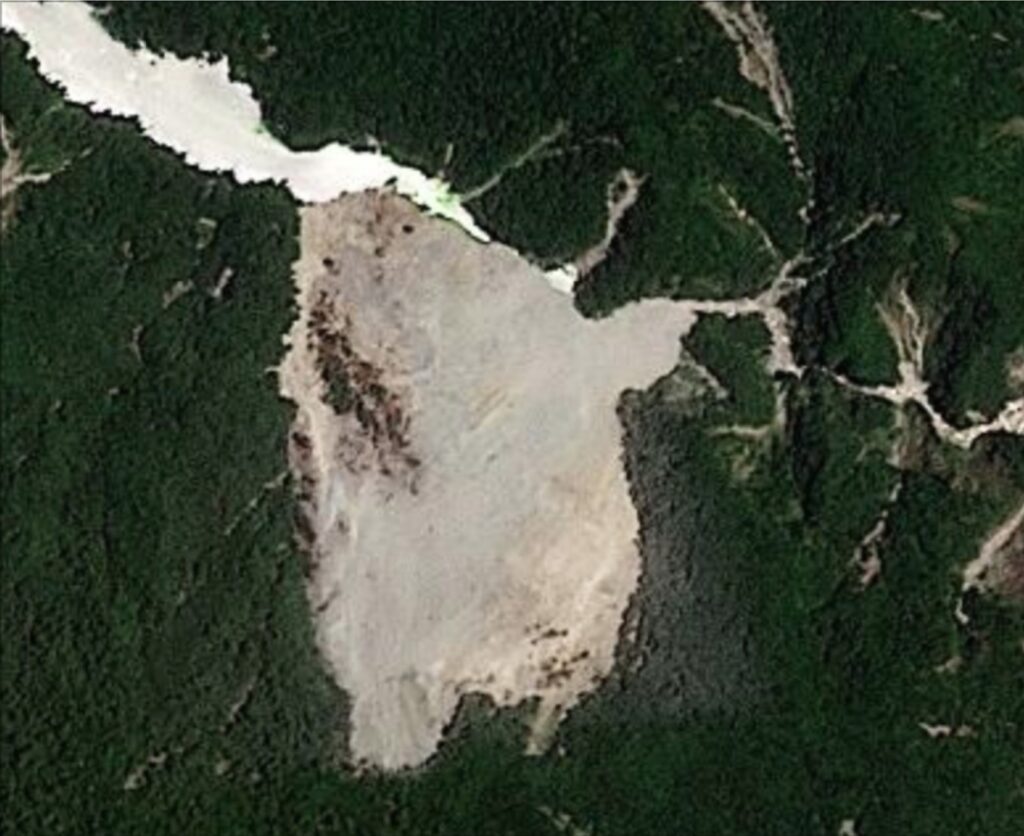
The lake is very clearly visible in the northwest corner, and there is dust on the eastern side, suggesting rockfall activity since the last period of heavy rainfall. This is an image compare with the day of failure (21 June 2026):-


There has been some retrogression and expansion of the landslide crown (at the south of the image). More importantly, the mass has crept down slope post failure, especially on the western side. You can see the movement between the images by examining the intact rafts of vegetation. As noted above, this is particularly apparent on the west side, but it can also be seen to the east too.
There are two interesting aspects to this imagery of the Wanlixi landslide.
First, the Planet Labs images could have been used in advance to track the development of the landslide prior to failure. In particular, the deterioration of the landslide mass and the generation of dust were good indicators that the slope was destabilising. Perhaps machine learning could be taught to monitor slopes across a wide area to detect these changes.
Second, the ongoing movement of the landslide mass is undoubtedly putting pressure on the natural spillway. This may be one of the reasons why it is still intact.
We are in typhoon season in Taiwan now, which could bring extremely heavy rainfall. The behaviour of the Wanlixi landslide and its spillway will be fascinating to watch should that occur.
Acknowledgement
Many thanks to Planet Labs for making the imagery available to me.
Text © 2026. The authors. CC BY-NC-ND 3.0
Except where otherwise noted, images are subject to copyright. Any reuse without express permission from the copyright owner is prohibited.
Source: Science – eos