

August days are often wet days in south Florida. After all, it’s typically one of our most soggy periods of the year. To start this week, though, is quite the contrary.
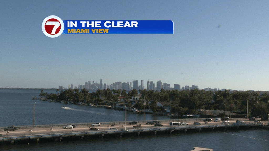
Check out the bright sky that persisted throughout the afternoon, Tuesday. Fortunately, there was a breeze arriving from the ocean (making the heat slightly more tolerable). As for the humidity, it was brutal and the numbers, below, prove it.
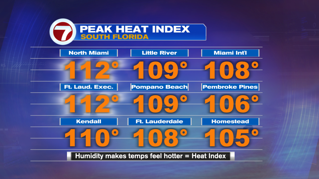
Locations in North Miami and at the Ft. Lauderdale Executive Airport had “feels like” temperatures (with the humidity factor) reaching 112º. It was expected so the National Weather Service had issued a Heat Advisory lasting into the early evening.
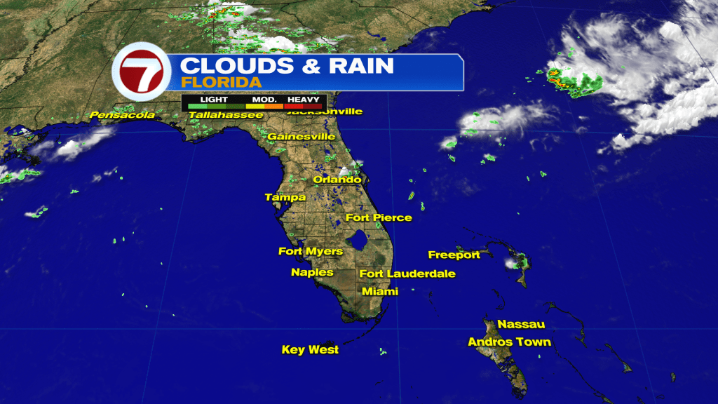
We are currently “in a quiet state” since Florida was basically void of rain and storms. Again, that’s entirely rare for this time of year! So, Will it last?
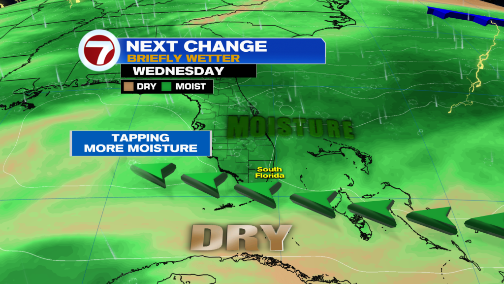
Looking ahead, all signs point to a modest surge of moisture from Wednesday through Thursday. It won’t be enough to bring widespread rain and thunderstorms, but scattered downpours are expected. The trend will also include lighter winds, so any pop-up’s will tend to be drifters.
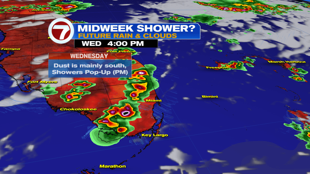
Inland areas will be favored for wetter conditions (as shown above, from our weather data model). Exact locations for future rain remains elusive but timing will confidently be during the afternoon.
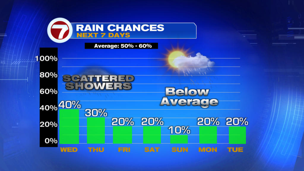
After Thursday, scattered downpours are likely to become more obsolete, once again. The reason? Drier air, mostly related to Saharan Dust, is forecast to spread our way before the weekend.
Source: News Miami – Fox News